↩ Tim Sahre

Environmental Informatics | Bridging Technology & Ecology for Better Futures
Interested in learning and implementing multidisciplinary approaches to complex questions and passionate about utilizing technology to solve pressing environmental challenges, my academic path has been a blend of environmental science and IT. During my studies, I mastered crucial technical skills in environmental information systems, databases, and web technologies, further developing my expertise in environmental analysis. I worked on projects ranging from the use of environmental information systems to ecological data analysis, combining theoretical knowledge with practical applications to solve contemporary environmental problems.
View My LinkedIn Profile
Congo Basin Habitat Analysis: Mapping Biodiversity with Geospatial Data

Mapping Biodiversity with Geospatial Data
Congo Basin Habitat Analysis
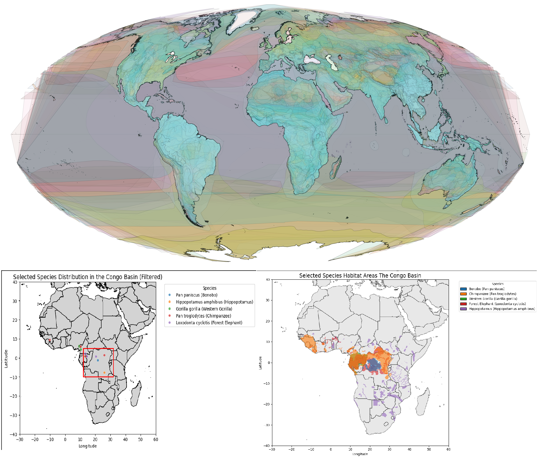
This project analyzes biodiversity in the Congo Basin using geospatial data, focusing on the habitat distribution of key species such as bonobos, chimpanzees, gorillas, forest elephants, and hippopotamuses. Using Python and libraries such as GeoPandas, Matplotlib, and Contextily, the habitats of these species are visualized on high-resolution maps, utilizing the Mollweide projection for accurate area representation.
Key Features
- Data Filtering and Visualization: Large datasets are efficiently filtered to focus the analysis on relevant species and regions, emphasizing the importance of data preparation for efficient processing.
- Habitat Mapping: Species habitats are displayed in distinct colors to highlight ecological patterns and relationships.
- Actionable Insights: Demonstrates how efficient data filtering and analysis techniques can contribute to conservation planning and biodiversity research.